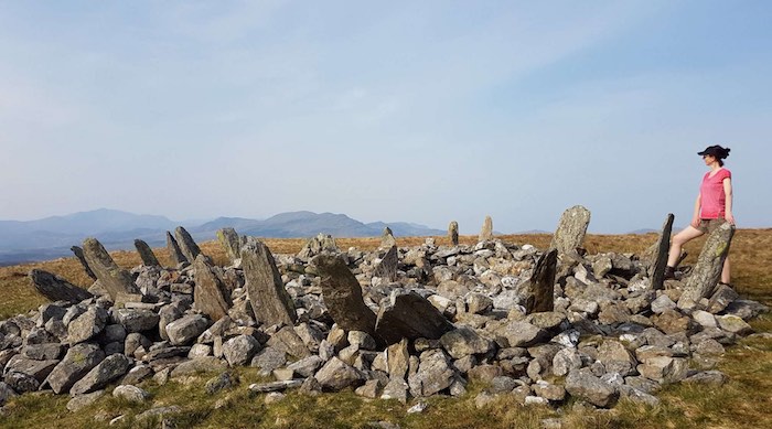
Bryn Cader Faner
This walk takes you to the ruins of an ancient stone circle up in the mountains that you can see across the estuary from Idris Bach. The ruins are believed to date back to 3000 years BC and the walk is beautiful. You can either walk all the way, or – as per the Llandecwyn Church walk – drive to Llyn Tecwyn Isaf and park there to start the walk, cutting out about 4 miles of steep walking.
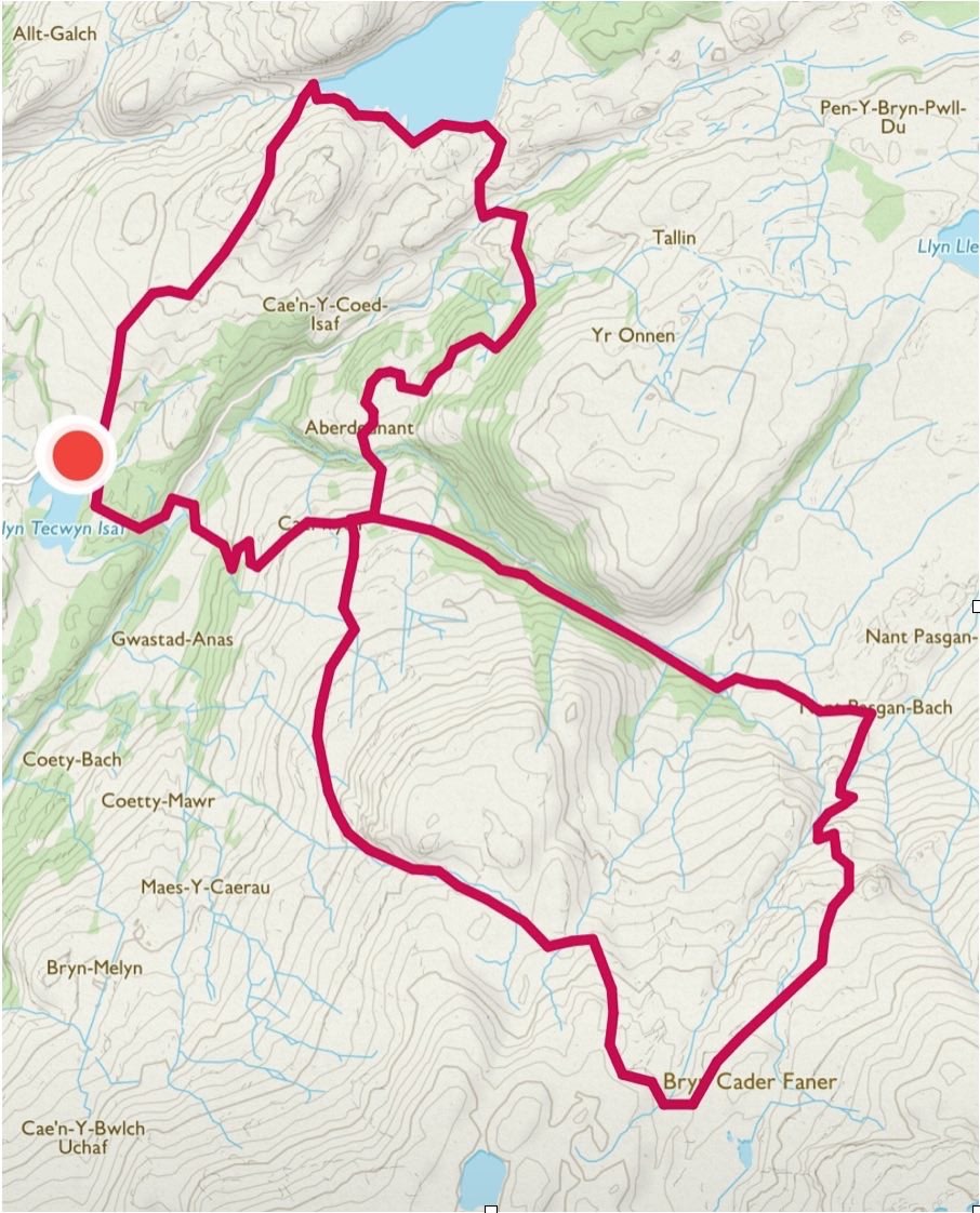
The total walk from the front door is approx. 10 miles and be warned, there are no shops, cafes or toilet facilities once you leave Penryhn, so go prepared! Take OL 18 map with you. There are also various route options for this walk, and having done it “wrong” (long story involving trudging around a boggy hilltop for some time, unable to find the ruins!), this is our recommendation…
- Follow the instructions for Llandecwyn Church up to the point where you reach Llyn Tecwyn Uchaf reservoir. At the reservoir, instead of taking the wide track to the right towards the church, follow the marked footpath around the right shore of the lake.
- After the lake, ignore a path off to the left and continue straight – turn left onto a paved lane, then right after about 50yds to continue on the marked footpath.
- When the path forks, turn right and then again slightly further on. Stay on this path (marked with the “Taith Ardudwy Way” markers) until you reach another single-track road by a farm called “Caerwych”. Turn right onto the road and then left about 100yds along, to head up hill through a field beside a wall.
- The path is clearly marked by the “Taith Ardudwy Way” markers from here to the ruins, and you’ll see the ruins jutting upwards on the crest of a hill ahead of you as you approach.
- For the return, you can turn around and come back as far as Caerwych farm, then turn left onto the single-track road and follow that all the way back home. (Before you reach Llyn Tecwyn Isaf, you’ll meet a junction in the road – turn left here. Just after the lake, turn right near the houses.)
- Alternatively, if you can find the path, continue onwards and round slightly to the left and very soon after the ruins, you’ll see a rocky peak with a stone wall around it, and from there you can see a farmhouse below (Nant Pasgan-bach), which is at the end of the same single-track road you crossed earlier at Caerwych. Head down towards the house and turn left onto the road and follow it all the way back via Caerwych farm and Llyn Tecwyn Isaf lake. As per above, just after the lake, turn right near the houses and follow the road all the way home.
(This alternate route is the way we took on the way out, and even after lots of sunny weather, it was pretty boggy and the path was not well marked, so a bit of an adventure for a while until you make it back to the road.)
The map shows the route if you start and finish at lake Llyn Tecwyn Isaf.